A Micklem Brothers 4 Peak Challenge
- Aug 23, 2020
- 9 min read
Updated: Aug 13, 2021

Having realised on Tuesday 11th August that the summer was quickly coming to an end, Sam proposed that we undertake the ‘Four Peak Challenge’. The idea was to summit the highest peak in each province of Ireland in under a week. Originally planning to leave on the Friday, we began our hurried research of our routes and where to camp. Looking over the maps for the Mourne mountains, where Slieve Donard is found, we came across the Mourne wall. The 35km wall was built between 1904 and 1922 along the catchment of the mountains to keep livestock away from the reservoir. Consequently the wall goes up and down all of the peaks in the area so we decided to leave a day earlier and walk to length of the wall while we were there, before summiting Mweelrea (Connaught), Carrauntoohil (Munster), and Lugnaquilla (Leinster).


I was working on Thursday morning, so we packed all our gear the loaded the car the night before to speed up our turnaround time. I arrived home by 12:30, Sam had lunch ready to eat in the car and we set off for Co. Down. Sam took first shift behind the wheel, driving through Dublin, Meath, and Louth we paid our only two tolls of the trip. Arriving in Newry, Co. Down, we headed East along undulating roads with vibrant green fields surrounded by giant stone walls on either side. We paused at Spelga Dam Reservoir before parking the car at Carrick Little.

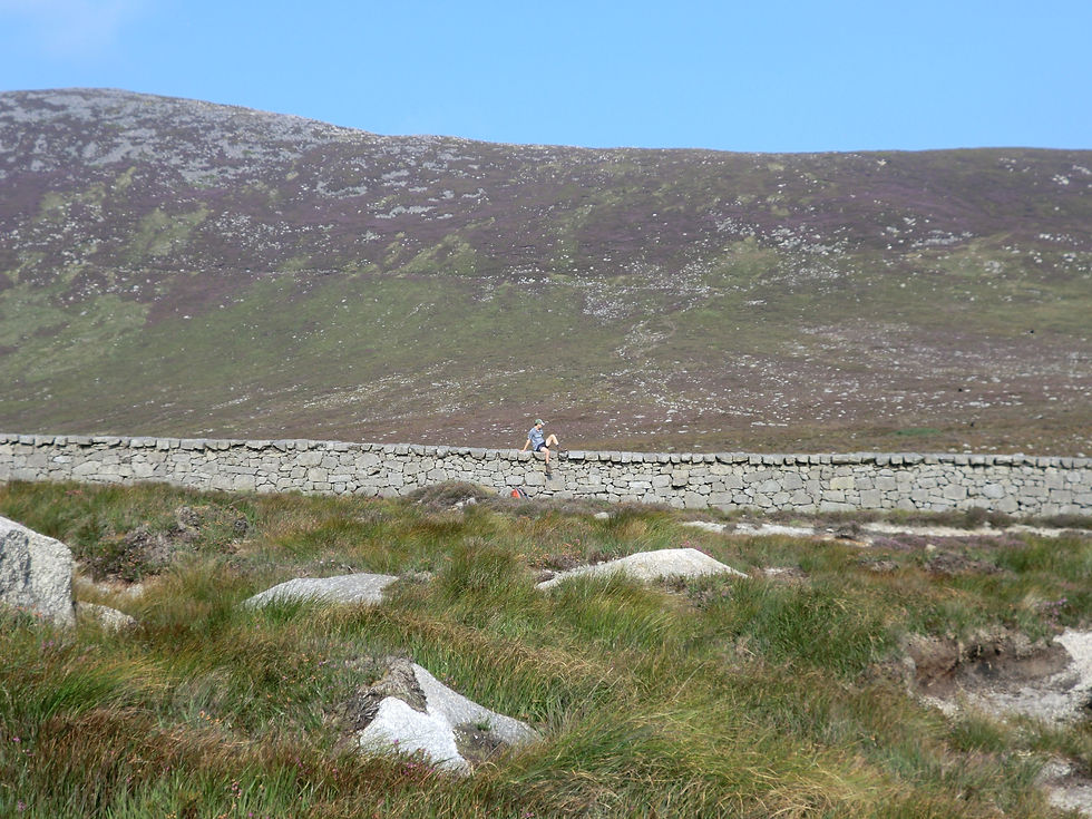
We decided to walk the wall in an anti-clockwise direction which meant walking a little way on the road to begin. We located a farm track which took us past some homes, into the forestry, before we turned sharply right and got our first proper glimpse of the wall. The wall is up to 8ft high and 3ft wide in places. The sun was splitting the stones as we followed the wall and began to understand how vast the construction was. With such good visibility, it was extremely clear where we would be walking with the monster wall stretching for miles in the distance.

There were giant stiles at various points to climb over the wall, so we made use of the first to allow us to walk along the top of the wall. It was a strange but wonderful experience. As we walked along, some of the stones on top of the wall were a little unstable so I was quick to point out to Sam that they were a bit rocky!


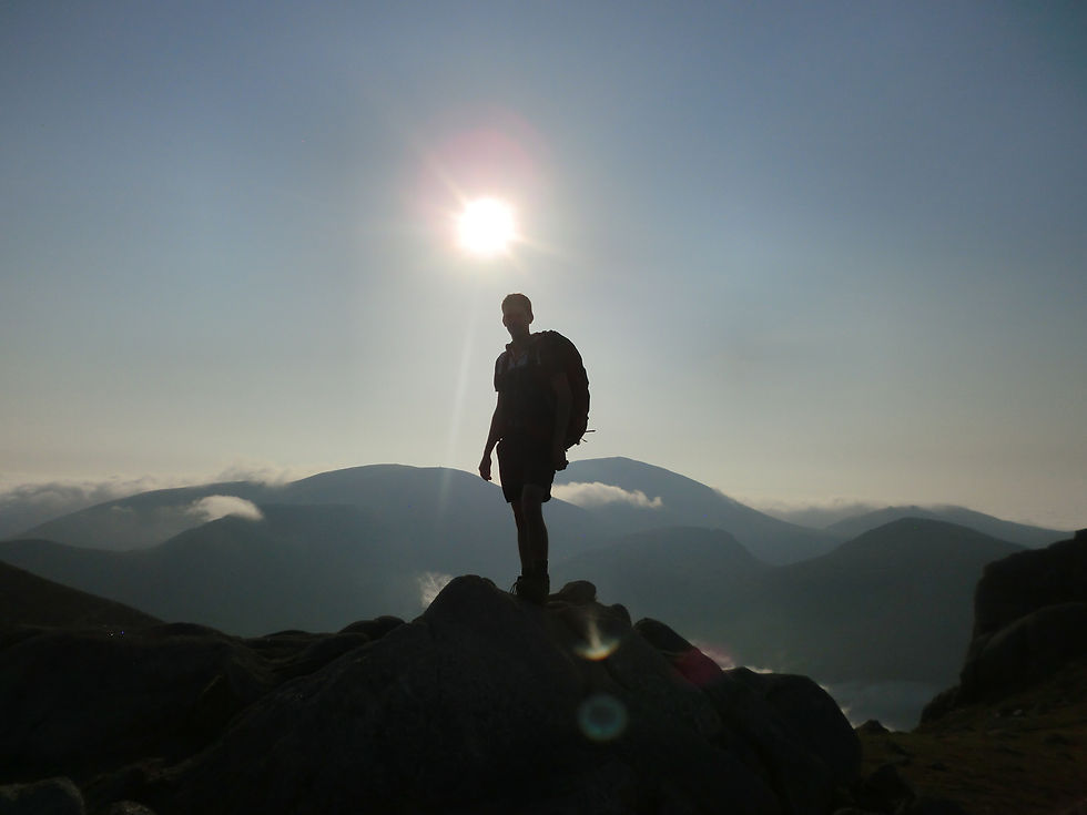
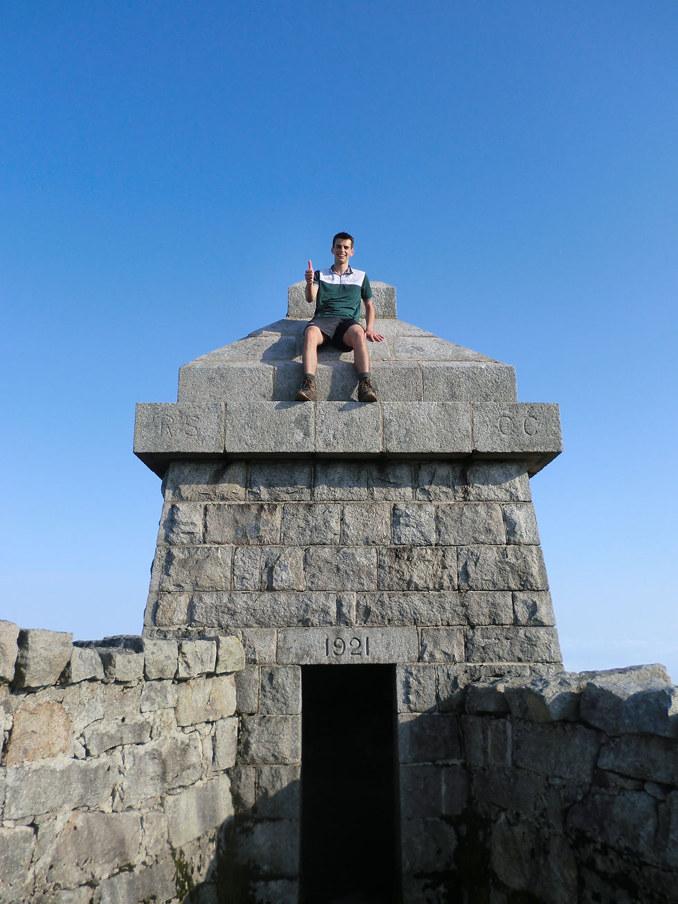
To begin with the wall tracked gradually upwards and towards Slieve Donard before suddenly becoming very steep as we completed the final ascent. Despite the beautiful weather, being the highest peak, the summit attracted the only cloud in the area so there wasn’t a spectacular view from the top but that didn’t bother us.

There was a gentleman who came to be known as ‘Teacup Man’, however. It’s relatively common for people to bring a thermos with them if they are just summiting a peak and coming down but it was rather entertaining to see Teacup Man perched on a rock with this teacup resting on another as he sipped his tea on the summit. From here we walked down the other side, following the wall, overtaking Teacup Man, before climbing again.
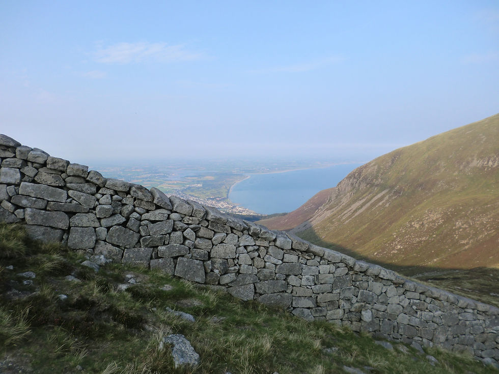

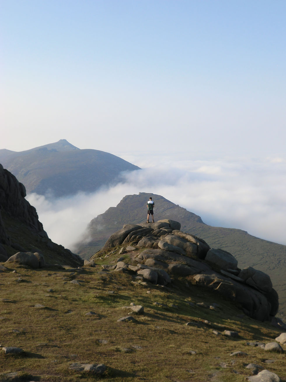
We were treated to a vista of the sun-kissed sea to one side and the valley to the other (at this point the wall no longer keeps the sheep on one side or the other). As we walked on and summited Slieve Commedagh and Slievenaglogh the hour was getting late. With such gorgeous views and lovely walking conditions we kept going until 20:15 before setting up camp by the wall in a saddle known as Hare’s Gap. Sam discovered a nearby stream so we could wash our sticky limbs and refill bottles for the next day.


We woke shortly after 06:00 on Friday 14th August to another beautiful sky. We were anticipating an overcast day, so we were keen to get walking and make the most of it. With everything packed up, it seemed like the clouds were chasing us but the way ahead was clear.
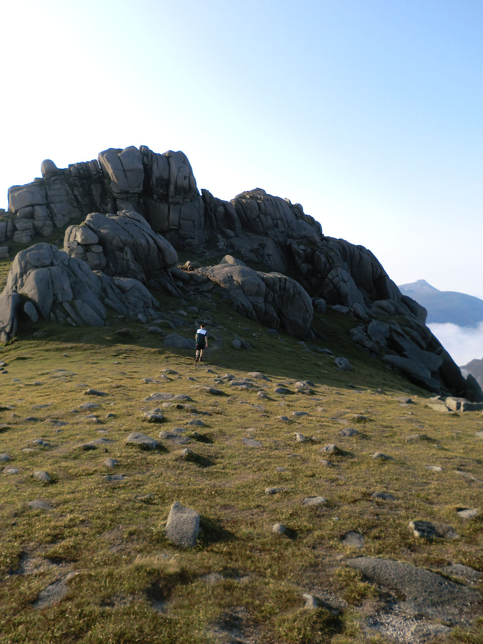
We first climbed Slieve Bearnagh where we found some large rocks jutting out of the mountain that were just asking to be climbed. We played on them for a little while, getting a good kick from the slightly increased danger before setting off again, very steeply down into another saddle and then less steeply up to Slieve Meelmore. This was some of the nicest walking we did on the entire trip.

From here we continued climbing steeply up and down several peaks in hot conditions until the clouds finally caught us on the top of Slieve Muck. With some respite from the sun we climbed down, walking through some very wet ground. As we neared the Silent Valley Reservoir, we were in the sun again and ready for a break. We managed to get some sun cream from a mother and had our lunch sitting on a bench. As we were eating a large crew from Tourism Northern Ireland passed as they were about to film a new advert.

After filling bottles at an outside tap, I walked along the road to the car, drove back to Sam, packed up and started driving to the West. Back through Louth and Meath we then passed through counties 5-8 with Westmeath, Longford, Roscommon, and Mayo. It took about 5 hours to get across the country. As we reached Westport the sun was just beginning to set behind the hills, giving lovely views of Clew Bay. We passed Croagh Patrick and pulled in at a layby near Mweelrea. I got out of the car to look for somewhere to camp, but I left my door open so when I returned there was a cloud of midges in my spot. I dived back into the car and Sam and I attempted to deal with the midges. We drove a little further and parked beside Doo Lough at the trail head for the summit the next day. We pitched the tent right beside the lake and cooked up a chorizo and tomato pasta dish before getting some well-earned rest.


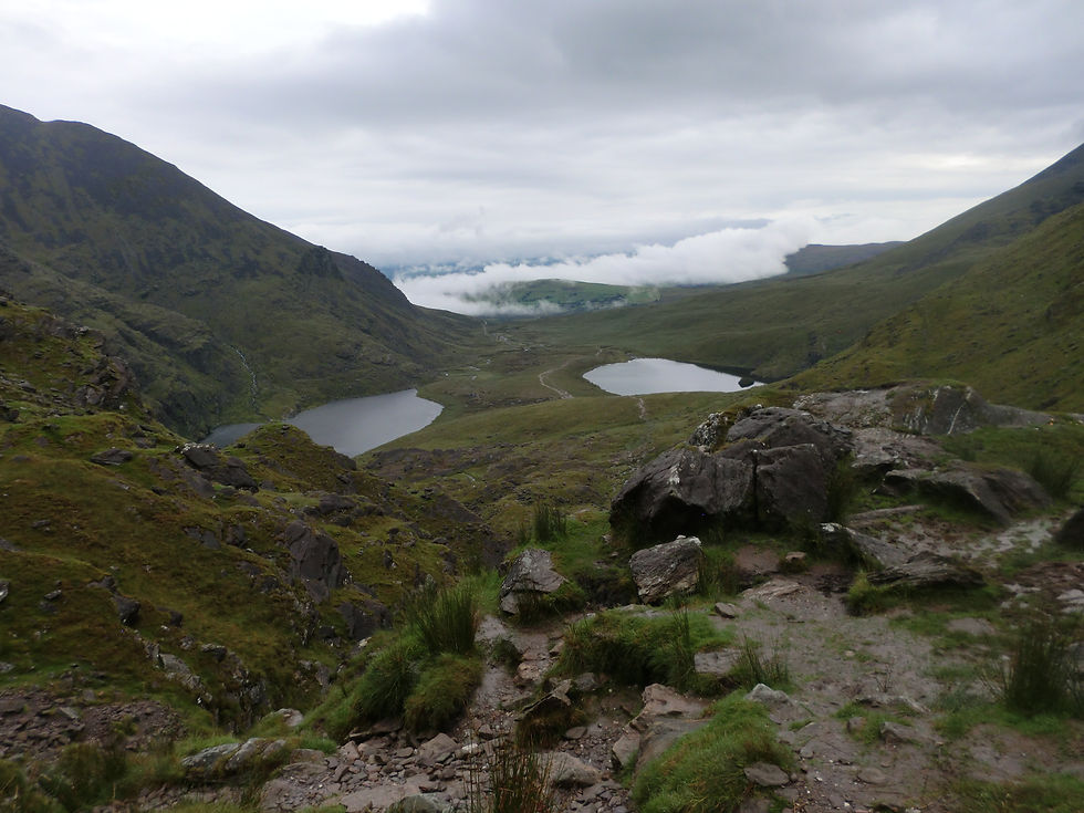
There were some clouds when we woke on the Saturday morning but by the time we packed up and moved the car to a better spot it had cleared up nicely. We were the first ones on the ‘trail’, though the instructions we were following described it as ‘pathless’. We walked along the north end of the lake, got to some sheep pens, and then headed across the wet bogland towards a cirque and imposing wall known as ‘The Ramp’. At the back of the cirque we climbed up a grassy bank on the left until we could go no further and then headed right along ‘The Ramp’. The path slowly became less steep but narrower, with the consequences for falling getting more severe, until we came out onto a slight saddle in the massif and could see the summit in the distance. We were conscious to keep our altitude as we walked across the sloped plain to the next saddle and after a small break for snacks, we tracked steeply up to complete our second peak. There was a smattering of clouds both above and below us which give the feeling of being at great altitude.

As we headed back, more clouds rolled in and made us thankful we got up early. We could see many more cars had parked beside ours and we met several groups on their way up as we descended. We were treated to the view back down into the valley as we retraced our steps down ‘The Ramp’, with the cirque and lakes below. Once we arrived back to the car, a little over 5 hours after starting, we stripped off and dove into the lake to cool off. It was just the perfect temperature and a great reward for our efforts. After cooking up the other half of our chorizo we hit the road again, this time driving towards Connemara, Co. Galway where my friend Duncan lives.

We pulled up around 16:00 to a small slice of heaven. With a freshwater lake, beach, wind turbine, home vegetable garden, kayaks, surf boards, quad, and fields upon fields the spot is idyllic. We first walked down to the lake with Duncan, his twin Josh, their girlfriend’s Rachel and Aishling, Rachel’s sister Abi, and Moose, the dog. The water was gorgeously warm as we swam 200m to an island in the middle and back. Duncan was a wonderful host and it was great to be able to catch up having not seen each other since the lockdown started. Their friend Lydia also joined us, and we had slow cooked pork with a vast array of home-grown potatoes, veg, and salad sitting around a fire pit. The smoke kept the worst of the midges away with add rosemary proving extra effective. After a great evening of food and conversation, Duncan gave Sam and I a lift up the hill, on the quad, to where our tent was pitched.

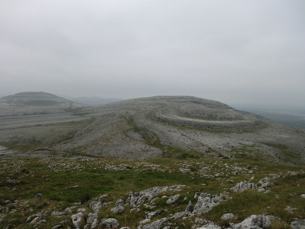
We had a lovely breeze all night and woke on Sunday morning to a gorgeous sunrise over the hills as we looked down on the beach below. Once all packed up and breakfast eaten, we set off for the Burren, Co. Clare. The day was quite overcast but also muggy as we drove south, picking up some more supplies on the way. We arrived at a trail head in the Karst Limestone landscape and decided to go for a short walk. It was quite easy walking with not too much elevation gain as we climbed up to a rocky summit and back down and round again. Sam described it as very melancholy and I found it quite lethargic. Sam’s biggest confusion was to what the walls were for, making the astute assessment that ‘It’s just rocks, really’.
As the rain started, we were on the road again, driving into county 12, Kerry. Our third summit was Ireland’s highest mountain, Carrauntoohil, located in the MacGillycuddy’s Reeks, so we were camping at a nearby cottage, belonging to the Goor family, on the coast. Louis and his son George were there when we arrived, along with George’s friend Freddie. Sam, Louis, and I went for a swim in the rain first thing as Louis told us about the poisonous Lesser Spotted Weaver Fish, he had caught that day! We cooked some potatoes and lamb chops and ate dinner with the family before retiring to our tent before the boys could make good on their threat to hide some crabs in it.

It was quite wet on Monday 17th and very overcast, so we were preparing to not be able to summit the mountain. However, as we pulled up to the trail head at Cronin’s yard, we appeared to be the first there and the clouds seemed to be lifting. We set off with high spirits following a clear path and onto a farm track between two corries before all real signs of a path disappeared as we began to climb ‘The Devil’s Ladder’. We were essentially climbing up a very steep stream. We made slow progress, but it was good fun and the clouds remained overhead. Once we reached the saddle, we were following some cairns and took one of many paths to the summit.


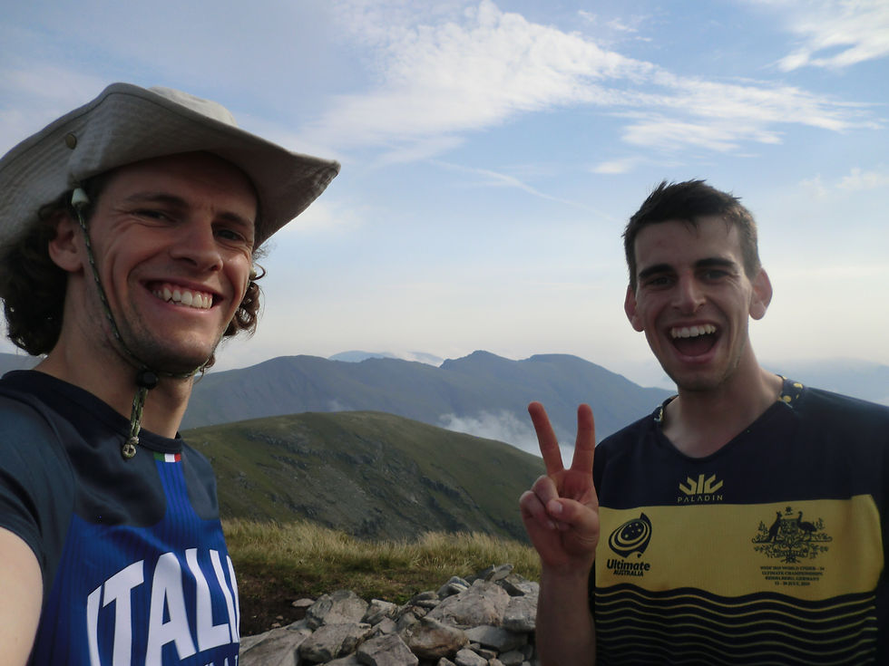
At this stage we were walking in the clouds and couldn’t see much but we thought there was a chance that the summit might just peak out over the top. We met two trail runners on their way down before we came out into a layer between the clouds and completed peak number three, with views between the clouds into the valley below. We enjoyed some food at the top before beginning to descend into the cloud once more. We met many more people on our way down so we were glad we set off so early. We got back to the car just in time to cook some tuna pasta for lunch and get underway.

We took a toll-free route which brought us through Cork, Tipperary, Kilkenny, Carlow, and finally Wicklow, totally 17 counties. As we got closer to our destination, both the roads and the weather seemed to get worse and worse. We arrived at Glenmalure and navigated our way to a place to pull in and camp. We had planned to hike into a hut on the Wicklow way and camp there but when we went to scope it out, we discovered it wouldn’t be feasible for tents or hammocks. We were shocked by the amount of rubbish where we were camping, and I felt ashamed that my home county was the worst of all the ones we had camped in. There were plenty of midges, so we ate dinner in the car and there were very low-lying clouds which didn’t fill us with confidence for the next day.
The clouds weren’t quite as low when we woke on Tuesday morning, so we set off for our final summit. We walked up six switchbacks on forestry roads (ignoring no entry signs) before cutting sharply up to the left along what was essentially a boggy stream. We passed a lake before our hopes of a cloud free summit were dashed. Into the fog we went, barely able to see 5m in front. We were momentarily led astray by a rogue cairn but soon reached the summit of Cloghernagh and from there it was a case of following a gradual incline for about half an hour through the fog to the summit. It was perhaps not the nicest walking, but we ploughed on and celebrated achieving our goal at the top.


The summit of Lugnaquilla remained in cloud but once we descended a little way the clouds began to lift and burn off and we were treated to lovely views of the Wicklow hills and some glorious sunshine. We retraced our steps back to the car, washing off our shoes in the river along the way. Finishing the drive home, we felt content with our little trip around the country which totaled over 1300kms and about 40 hours of walking. Stepping in the door, the new kitchen counter was just being finished and with washing to be hung up, our holiday was very swiftly over!


Comments